You are currently using an outdated browser.

Please consider using a modern browser such as one listed below:

Cambridge Pixel Customer Login

Customers

GPS Assist

Products » Tools and Downloads » GPS Assist

Ensure Continuous Navigation in GPS-Denied Environments

Radar-based solution for detecting and compensating for loss, spoofing or jamming of GPS information.

Request a Quote
GPS Assist
GPS Assist

An Essential Safety Backup for USVs

Works seamlessly with existing maritime radars on ships and uncrewed / unmanned surface vessels.

Ask a Question

Key Features

Provides continuous navigation output during GPS faults.

Compares Radar Data with GPS Position

The software uses radar data to estimate the lat/long position by comparing the terrain and coastline information with predicted radar returns from a database. The calculated position is compared with GPS-received position to check for missing, spoofed or jammed GPS signals.

When such a condition is detected, GPS-Assist can raise an alarm and create its own stream of NMEA-based navigation data with the goal of providing emergency navigational information.

Uses Existing Maritime Radars

GPS Assist works with existing maritime radars. The ship’s normal processing and display of the radar data is unaffected by GPS Assist, which simply piggybacks on to the data stream to process the radar video. 

Web Browser Interface

The web browser interface provides initial configuration tools, live and predicted radar video images, and the features used for matching. It displays the estimated position of the ship performance settings can be adjusted. Once configured, GPS Assist runs as an unattended server application under Windows or Linux, with network messages used to report status and, if desired, provide a runtime control interface.

GPS Assist

GPS Assist Details

Extra Info

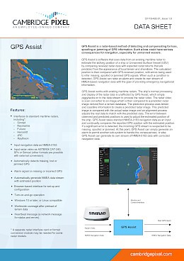
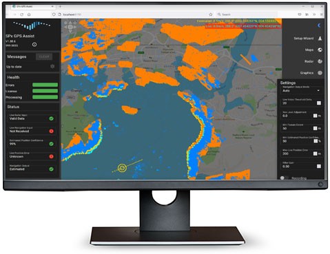
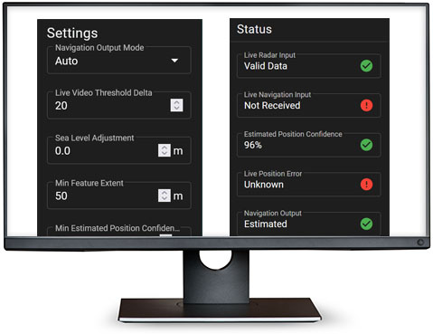
How does GPS Assist Work?

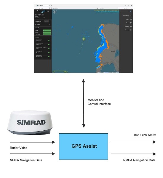
The radar video is scan converted to an image which is then compared to a predicted radar image derived from a terrain database. The prediction process uses terrain and coastline information to create a predicted radar image. This predicted image is compared with the actual radar image and an alignment process adjusts the real data to match with the predicted data. The error between observed and predicted positions is used to adjust the estimated position of the ship.

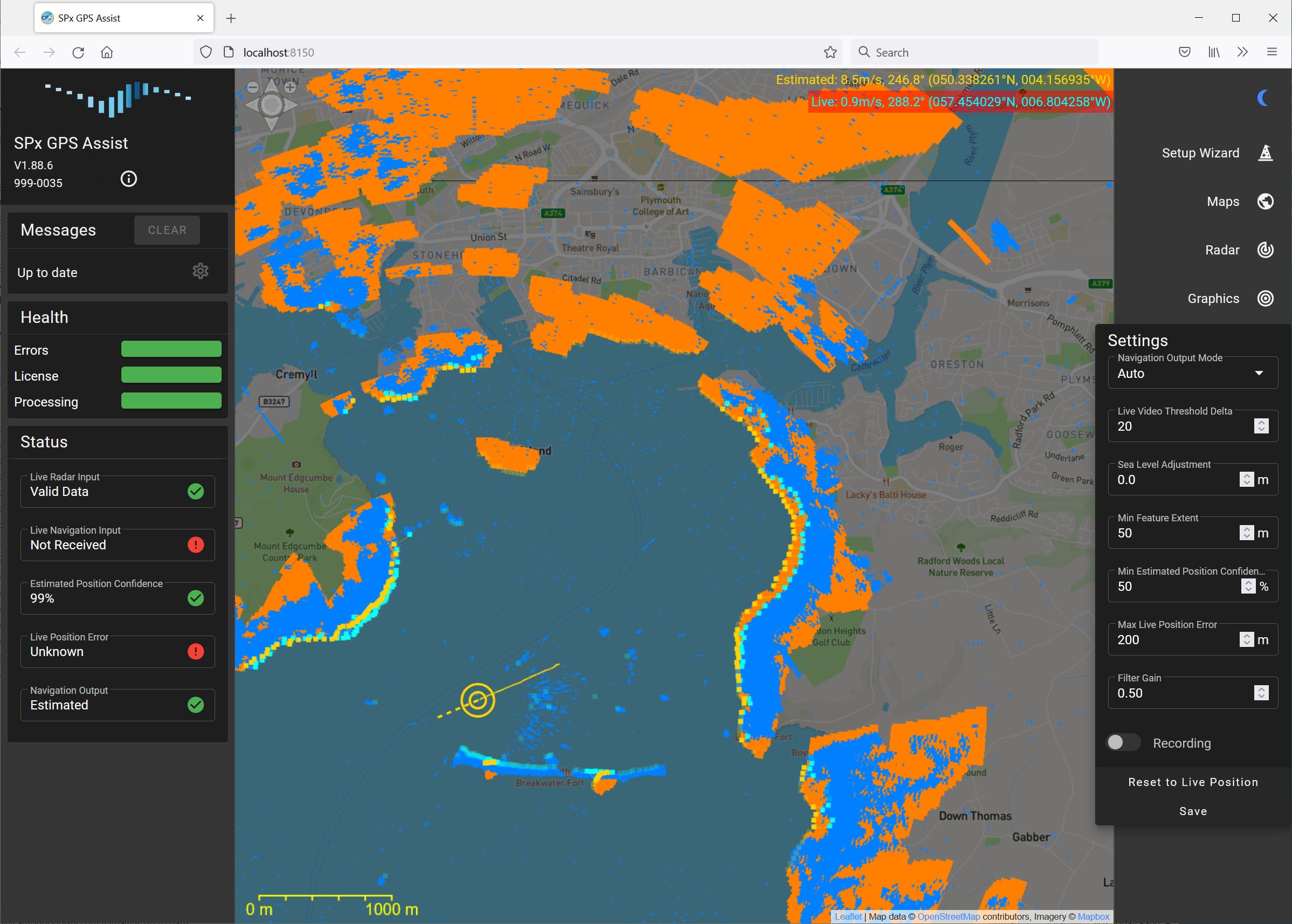
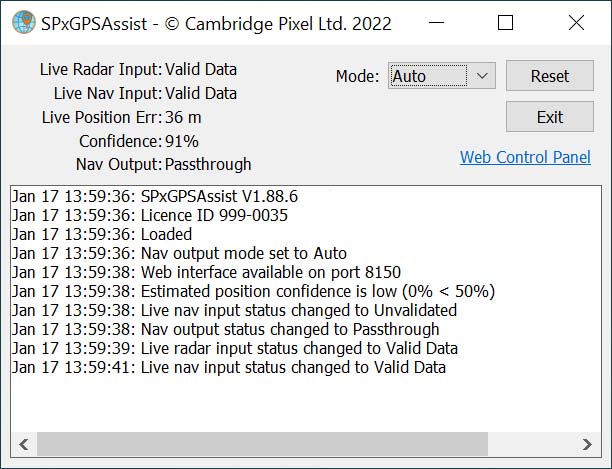
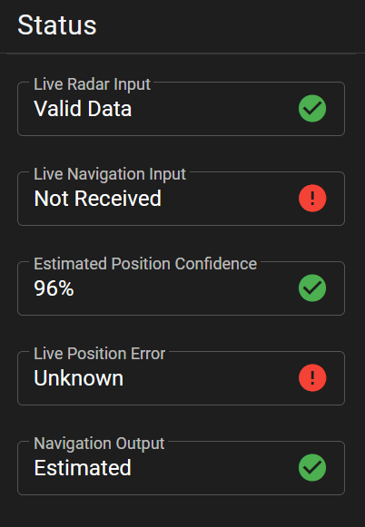
GPS Assist takes standard NMEA-0183 navigation data as an input and continually compares the reported GPS position with the estimated position. If a significant error is detected, the incoming GPS stream is suspected to be missing, spoofed or jammed. At this point, GPS Assist can simply generate an alarm to permit another sub-system to handle the consequences, or else GPS Assist can generate its own stream of NMEA-0183 data with corrected navigation data.

GPS Assist provides continuous navigation output during GPS faults, gives greater confidence in decision-making and improves safety. 

GPS Assist

Features
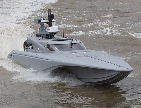
  • Interfaces to standard maritime radars, including*:
    • Simrad
    • Raymarine
    • Furuno
    • Hensoldt
    • JRC
    • Raytheon
  • Input navigation data as NMEA-0183
  • Input radar video as ASTERIX CAT-240, SPx or Simrad (other formats are possible with external conversion).
  • Automatically detects missing, lost or jammed GPS
  • Alarm signal on missing or incorrect GPS
  • Automatically generate NMEA data stream with estimated position
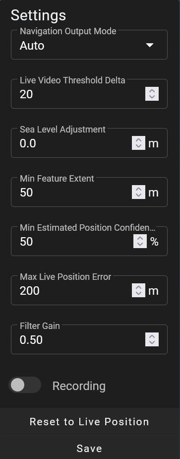
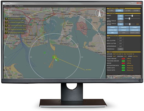
  • Browser-based interface for set-up and configuration
  • Turn-on-and-go operation
  • Windows 10 or later, or Linux compatible
  • Worldwide coverage after preload of terrain data
  • Heartbeat message (a network message for status and errors).

* A separate radar interface card or format conversion module may be needed for some radar models.

Docs
GPS Assist Datasheet
Cambridge Pixel Product Summary Brochure
Images
Radar Solution
GPS Assist works by comparing real radar video (blue in the above) with predicted video returns calculated from a terrain database (orange in above). By shifting the position of features in one image to find the best fit, the true position of the ship is estimated.
Radar Solution
Settings Options
Radar Solution
Status View
Video
GPS Assist